Ride Information and Ratings:
- Data: Feb. 27, 2016
- Distance: 178,3km
- Total Ascent: 3.441 meters
- Location: Rio and Angra dos Reis
- Total Riding Time: 8:24h riding, 10:06h total
- Scenic Views Rating: 8 - Pretty views
- Ride Safety Rating: 5 - Not the safest ride
- Level of Exercise Rating: 10 - Extremely hard
- Type of Terrain: Asphalt in good condition
- Description of Terrain: Asphalt the entire ride. From Gávea until Rio-Santos, it was mostly riding on the side of regular roads with traffic. On Rio-Santos, most of the time there is a shoulder in good condition, although in some parts (and on all climbs) there is no shoulder, but there is enough room for sharing the roads with the cars.
- Ride Map: https://www.strava.com/activities/503739014
Ride Details:
- This ride mixes city riding, hills and road.
- It´s a ride for advanced riders, mostly because throughout the entire ride we are very close to traffic.
- The only part that is not very enjoyable from a scenery perspective, is while going through the city of Santa Cruz.
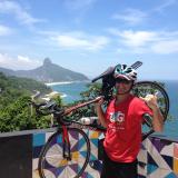
- The ride in Rio is very nice, and can be even nicer if the Barra and Recreio cycle paths are chosen, rather than Av. das Américas.
- Going through Prainha and Grumari, then crossing through Serra dos Cabritos, instead of going through Grota Funda, is also recommended, although it will increase the ride distance.
- Because we had to ride in the Audax on the following day, we chose the shortest route possible, which included going through 2 tunnels on Rio-Santos. Riding through the tunnels was not as bad as I had thought, as they are short (600 meters) and offer space for sharing the lane. The second tunnel (Mangaratiba) was very dark, so I recommend having a strong flashlight to light the way. The first tunnel connect Itacuruçá and Muriqui. Both tunnels can be avoided by going on oceanside roads, however, each time the ride will increase by 5km.
- There are some decent climbs, but none are very long. The first one is the Grota Funda, then there is one climb before each tunnel (the climb before the second tunnel is the longest). The hardest climb is about 15km after Conceição de Jacareí. Just about every climb comes with a great view and an even better descent.
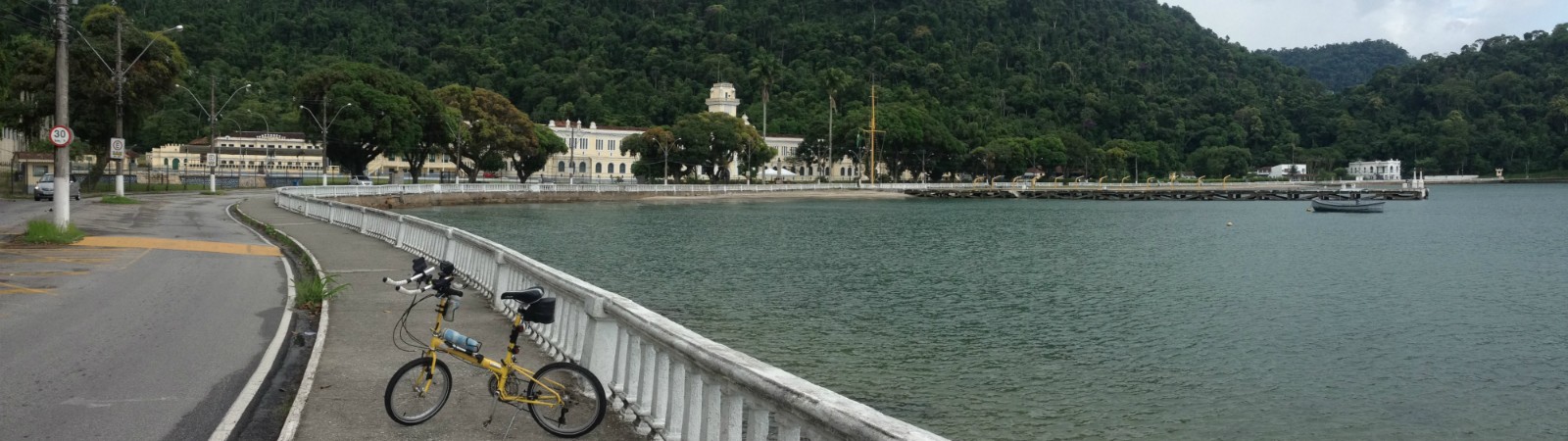
- Angra dos Reis is not a very interesting city, it´s very small and has slums in just about every direction you look. The actual city is on the Atlantic ocean, but it is surrounded by hills and mountains, that would be amazingly beautiful, if it weren't for the irregular construction that has grown out of control. Angra´s main entertainment are the boat ride, as it has many marinas and the famous pier with some restaurants. Near the pier there are some local shops an squares in what is called the Historic Center, but it mixes architectural historical buildings with old, not well maintained ones. My favorite spot was the Colégio Naval beach area. It´s the only place that probably hasn't changed much in the last 50 years, and it passes a sense of peace and tranquility, that were even more present as I finished this 178km, 10-hour trip watching the tiny waves break in front of the historical naval building.
Photos:


Video:
- Em breve.
Ride Information and Ratings:
- Data: Feb. 27, 2016
- Distance: 178,3km
- Total Ascent:3.441 meters
- Location: Rio and Angra dos Reis
- Total Riding Time: 8:24h riding, 10:06h total
- Scenic Views Rating: 8 - Pretty views
- Ride Safety Rating: 5 - Not the safest ride
- Level of Exercise Rating: 10 - Extremely hard
- Type of Terrain: Asphalt in good condition
- Description of Terrain: Asphalt the entire ride. From Gávea until Rio-Santos, it was mostly riding on the side of regular roads with traffic. On Rio-Santos, most of the time there is a shoulder in good condition, although in some parts (and on all climbs) there is no shoulder, but there is enough room for sharing the roads with the cars.
- Ride Map:Ride Map: https://www.strava.com/activities/503739014
Ride Details:
- This ride mixes city riding, hills and road.
- It´s a ride for advanced riders, mostly because throughout the entire ride we are very close to traffic.
- The only part that is not very enjoyable from a scenery perspective, is while going through the city of Santa Cruz.
- The ride in Rio is very nice, and can be even nicer if the Barra and Recreio cycle paths are chosen, rather than Av. das Américas.
- Going through Prainha and Grumari, then crossing through Serra dos Cabritos, instead of going through Grota Funda, is also recommended, although it will increase the ride distance.
- Because we had to ride in the Audax on the following day, we chose the shortest route possible, which included going through 2 tunnels on Rio-Santos. Riding through the tunnels was not as bad as I had thought, as they are short (600 meters) and offer space for sharing the lane. The second tunnel (Mangaratiba) was very dark, so I recommend having a strong flashlight to light the way. The first tunnel connect Itacuruçá and Muriqui. Both tunnels can be avoided by going on oceanside roads, however, each time the ride will increase by 5km.
- There are some decent climbs, but none are very long. The first one is the Grota Funda, then there is one climb before each tunnel (the climb before the second tunnel is the longest). The hardest climb is about 15km after Conceição de Jacareí. Just about every climb comes with a great view and an even better descent.
- Angra dos Reis is not a very interesting city, it´s very small and has slums in just about every direction you look. The actual city is on the Atlantic ocean, but it is surrounded by hills and mountains, that would be amazingly beautiful, if it weren't for the irregular construction that has grown out of control. Angra´s main entertainment are the boat ride, as it has many marinas and the famous pier with some restaurants. Near the pier there are some local shops an squares in what is called the Historic Center, but it mixes architectural historical buildings with old, not well maintained ones. My favorite spot was the Colégio Naval beach area. It´s the only place that probably hasn't changed much in the last 50 years, and it passes a sense of peace and tranquility, that were even more present as I finished this 178km, 10-hour trip watching the tiny waves break in front of the historical naval building.